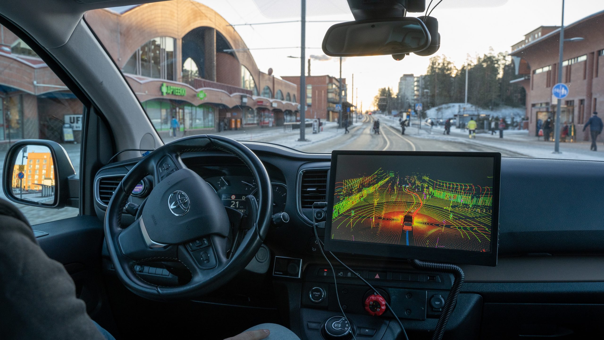
A high-definition map (HD map) is one of the cornerstones of utilising a test area for autonomous driving. Tampere Testbed Hervanta is offering plenty of opportunities for companies to test their smart traffic and automated mobility services in a genuine urban environment.
Typical automotive navigation systems will be accurate to a couple of metres, which is not sufficient for the automated vehicles. That’s why Tampere Testbed Hervanta now provides a HD map, accurate to one centimetre and indicating exactly where various elements are located: lanes, pavements, kerbs, traffic lights, bus and tram stops, road markings and signs, etc.
– Automated vehicles require both accurate map data and landmarks for positioning support. The HD map provides them all, says Matti Kutila, Research Team Leader at VTT Technical Research Centre of Finland.
The HD map is a small but important part of the digital twin of the test area in Hervanta. The digital twin makes the testbed highly accessible for all third party companies. The twin is created by Sitowise, the smart city company.
– The digital twin lowers the threshold of testing in Hervanta, when companies may first visit the site in the virtual world and develop their algorithms, says Kimmo Kauvo, Senior Scientist at VTT.
The HD map was made according to companies’ wishes
In the beginning of 2021, two workshops were organised, initiated by the City of Tampere and Business Tampere. The workshops investigated the test area requirements together with VTT and several companies related to automated driving. The need for a HD map was noticed then, and a basis for the map project was created.
– After that we examined interfaces in Tampere and in Finland, from which we could gather data. We also checked whether they were up-to-date and operational. In the second phase, a test route HD map was compiled, says Kutila.
Now the HD map of Tampere Testbed Hervanta is on the VTT background server, in an open format that automated vehicles understand. VTT is using the map for its own test and research purposes.
– VTT also enables other stakeholders to join the activities, so they can start to develop their own HD map modules, says Kutila.
The HD map and the digital twin
In order to be useful for research and product development, the test area needs both physical and digital infrastructure. The digital side consists of the digital twin, the HD map, etc. Fast communication networks are essential, as well as the actual area with all the services.
– Tampere Testbed Hervanta is now equipped with such a convincing infrastructure, that we are gaining access – and getting invited – in significant international projects and consortiums, says Kauvo.
The year 2022 begins in Hervanta by testing self-driving cars: a 2,5-month feeder service trial for the tramline. Anyone can try the service free of charge. The automatic driving pilot is a part of the international SHOW project. Sensible 4, Sitowise, the City of Tampere and VTT are participants from Finland.
– At this phase, Sensible 4 is developing autonomic driving technologies suitable for last mile solutions. For the purpose, the route in Hervanta is almost perfect, says Jussi Suomela, CBO of Sensible 4.
The Hervanta area HD map will be developed further for example by building dynamic layers to the map. Elements that may be added are such as traffic congestion data collected by vehicles or current weather data from other sources. Based on this data, it is possible to predict spots that are potentially dangerous, and share the information with other street users.
Author: Päivi Stenroos
Photo: Sensible 4


